
I can't believe I went all day with video posted that did not work. For some reason, You Tube does not like the computer model video I showed, so today I will just post the link. Before you check out today's video below- please help me out with the poll on the right. I know some of you have problems playing video on your work computers. This may help me with more posts in the future...
Below is video I recorded over Loch Raven Reservoir when I was working in 'News Chopper 11" back in the fall of 1998. It was a common scene in around sunrise, but I only took video this morning. In retrospect I wish I had done more.
This is Steam Fog that is pretty common in the fall with longer cooler nights, and water that is relatively warm.
To answer the question from yesterday: No, I do not think we can rule out another 80F day. We hit 79F Sunday and Monday. The normal high is in the mid 70s, so a bump a few extra degrees should not be that hard. Also, fall around these parts is a gradual change with give and take. Almost like a marriage with early compromise, until one spouse dominates. No, not in my house, but I digress. These cool snaps are part of the give and take. Often when it gets cool too fast, the reverse will balance out within a week or two. Consider this past September: The 6th was wet with a high of 78F, but by the 13th we were back to 93F. I do believe fall is settling in early than we are use to, and winter will be here by Thanksgiving, but a few more warm days will pop up in between.
The next few days will seem like fall is in full swing. Yesterday I tried to post a movie of the Canadian Model showing a coastal low pushing into New Jersey. 
This morning, the outlook is not as threatening for us, but still quite wet. The initial low will slide into North Carolina and spread rain our way by Thursday afternoon and last into the weekend. Combined with strong High Pressure in eastern Canada, we will have a steady east to north east flow keeping us int he 60s and wet. A secondary storm will form off of the coast, but instead of reaching us, it will head towards New England. Here is a link to the Penn State eWall. Slide your cursor along the top (hours are listed as (f36, f48, etc) to see the movement of the Low Pressure off of the coast work back north and west.
My Examiner Home Page- Click this image to view.

Wednesday, September 24, 2008
Fog Video Coastal Storm

Wednesday, September 17, 2008
Steam Fog
September and October are fog season. The longer, cooler nights and relatively warmer water often produce foggy mornings. I use to see this over Loch Raven Reservoir when I was flying in the helicopter every day. Here is a pond at The Greens in Ijamsville. You can see the fog forming off of the warmer water just like steam rising from a hot bath. While it has not completely cleared out yet, it will soon.
Wednesday, April 23, 2008
Flares on Balloons?
It appears that there might have been a hoax involved with the lights over Phoenix Monday night.
A man has come forward saying that he saw his neighbor launch helium balloons with flares hanging from them. More from azcentral.com. It might be a disappointment to some, and this goes beyond the scope of my blog. One day, maybe....
We can thank clear skies overnight, moist ground from recent rain, and a light easterly flow to get this to form. Usually this 'radiation fog' forms in valleys where the temperature gets colder and can reach the dew point first. You'll notice the parking lot does not have fog, since the blacktop holds in some of the heat. The hilltops also were fog free since overnight conditions create and inversion- warmer air rises and sits just above the ground, while the valley floors cools off. During the day, the sun heats up the ground, and the lower elevations end up warmer than the surrounding hills as that rising air cools.
Wednesday, April 9, 2008
The numbers are up!
Temperatures and Hurricanes
First: Our temperatures...It's been an interesting ride this week with our marine layer. While just about every morning has had fog, each afternoon has punched a bigger hole in the cloud deck. As a result- our temperatures have jumped each day.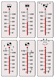
Tue: 51F
Wed: 61F
Considering that our normal high is 63F- this has been a big improvement. Now we get the flip side. We can thank the cold front (producing severe storms out west in the Mississippi Valley) for shifting our winds and bringing us back above normal by this afternoon. Think of it this way- our sun angle now - nearly 3 weeks after the Spring Equinox- is roughly equivalent to the sun angle 3 weeks before the Fall Equinox. That is early September when normal high temperatures are 82F. That does not happen often in April since the ground and water is still warming up from it's winter chill. However there is solar support- so low 70s are pretty likely once we get the sun back out.
Tension in the Tropics:
An increase in the 2008 hurricane forecast was released by Dr. William Gray yesterday. 
It should be noted that most tropical experts agree that we are in a normal 30 year cycle of increased tropical activity. The extremes 2004 and 2005 are not expected to repeat, and as I wrote yesterday- there are other factors such as African dust storms that could inhibit storm formation.
Tropical Cyclone Forecast for 2008
(1950-2000 Averages in parenthesis)
- Named Storms 15 (9.6)*
- Named Storm Days 80 (49.1)
- Hurricanes 8 (5.9)
- Hurricane Days 40 (24.5)
- Intense Hurricanes 4 (2.3)
- Intense Hurricane Days 9 (5.0)
- Net Tropical Cyclone Activity 160 (100%)
* Numbers in ( ) represent average year totals based on 1950-2000 data.
Tuesday, February 5, 2008
Super-Foggy-Tuesday!
Or should we call it Soup-er Foggy? There was a dramatic development of fog between 
I can not post our time lapse loop here (I am working on it), but below is Glen Burnie from AA Comm College. The lights are on Richie Highway. Visibility severely limited with some reports down to near ZERO:
This is a textbook result from a moist cool damp easterly wind about to be displaced by a warm front. Fog often get very thick as the warm air is about to move in. In fact the warm air moves in aloft first since it is less dense and rises. But it does take a while to move in at ground level.


 Posts
Posts


