View this full web site Click: JustinWeatherTalk.com. New Blog located at Examiner.com. Local weather and interactive radar at abc2news.com.


My Examiner Home Page- Click this image to view.


Friday, September 12, 2008

Ike Could Be Worse than Katrina

The slight shift in the track over the past 12 hours has put the direct target on Galveston and Houston, Texas.
There is agreement among most of the models on this path, which actually puts this metropolitan area closer to the path of the eye wall, which is where the strongest winds are found.
As of 5am, the winds increased slightly to 105mph. More important is that the hurricane force winds extend 120mph from the center. The tropical storm force wind field extends 450 miles from end to end. A large storm that will effect a large area.
This is going to be bad! There is no way to sugar coat this, and I do not think the hype is too much. The famous 1900 hurricane that killed 8,000 people prompted the building of a 17 foot sea wall in Galveston. It has yet to be challenged by a Hurricane. This storm should build a 15 foot storm surge with waves 32Ft tall as it makes landfall around high tide. Add in over 12 inches of rain and tornadoes on top of the max winds, and I have a hard time accepting that this storm will spare this metropolitan area.


The NFL made the move last night to postpone the Football game between the Ravens and Houston Texans has been postponed until Monday night. Is this a good move? Of course the game should not take place on Sunday, but what about the conditions of Houston on Monday. The damage to the infrastructure, plus the displacement of most of the population will make any travel difficult. Even if Reliant Stadium does survive better than the Superdome, and they have generator power- what about the rest of the region. While I have a fantasy football player in this game, I don't think this was thought out properly. Perhaps the game should have been moved to New Orlean's Superdome, or even one of the University stadiums inland. What do you think?

It should be noted that the National Weather Service put out a statement yesterday saying "People in the path of this storm will face imminent death". That is the same statement put out 1 day before Katrina hit New Orleans. At that time the storm was a Category 5. This storm is still a Category (as of early Friday). Here is the rest of the statement from the NWS for Galveston and Houston areas:

...PRECAUTIONARY/PREPAREDNESS ACTIONS...

DAMAGING WINDS ARE EXPECTED.

PERSONS SHOULD PREPARE THEIR PROPERTIES FOR THE POTENTIAL OF
DAMAGING WINDS. SECURE OR REMOVE ANY LOOSE ITEMS SURROUNDING YOUR
PROPERTY WHICH COULD BE BLOWN AROUND BY TROPICAL STORM OR
HURRICANE FORCE WINDS. TRIM TREES NEAR YOUR PROPERTY.

MOST MOBILE HOMES WILL EXPERIENCE MODERATE TO SUBSTANTIAL DAMAGE.
SOME OF POOR CONSTRUCTION WILL BE UNINHABITABLE UNTIL REPAIRED.
HOUSES OF POOR TO AVERAGE CONSTRUCTION WILL HAVE DAMAGE TO
SHINGLES...SIDING...AND GUTTERS. SOME WINDOWS WILL BE BLOWN OUT.
UNFASTENED HOME ITEMS OF LIGHT TO MODERATE WEIGHT WILL BECOME
AIRBORNE...CAUSING ADDITIONAL DAMAGE AND POSSIBLE INJURY. DOZENS
OF WIRES WILL BE BLOWN DOWN. LOCAL POWER OUTAGES WILL AFFECT
ENTIRE NEIGHBORHOODS.

MANY LARGE BRANCHES OF HEALTHY TREES WILL BE SNAPPED...AND
ROTTING SMALL TO MEDIUM SIZED TREES WILL BE UPROOTED.

...WINDS...

TROPICAL STORM FORCE WINDS IN EXCESS OF 39 MPH ARE EXPECTED TO
REACH INTO THE LIVINGSTON TO HEMPSTEAD COMMUNITIES BEGINNING
8 TO 10 PM FRIDAY NIGHT. THESE WINDS ARE EXPECTED TO OCCUR FOR
AN 16 TO 24 HOUR PERIOD. WIND GUSTS OF 50 TO 80 MPH WILL BE
POSSIBLE OVER AREA.

...INLAND FLOODING...

A FLOOD WATCH IS IN EFFECT FOR THE HEAVY RAINS THAT WILL ACCOMPANY
THE PASSAGE. WIDESPREAD RAINFALL OF 2 TO 4 INCHES WITH ISOLATED
TOTALS OF 6 TO 10 INCHES WILL BE POSSIBLE FRIDAY THROUGH SATURDAY.
SIGNIFICANT FLOODING WILL BE POSSIBLE IN AREAS OF HEAVIEST RAINFALL.

...TORNADOES...

THE THREAT FOR TORNADOES WILL GRADUALLY INCREASE LATE FRIDAY
AFTERNOON AND CONTINUE THROUGH SATURDAY EVENING AS THE
RAIN BANDS ASSOCIATED WITH IKE SPREAD INLAND. BASED ON THE
CURRENT FORECAST TRACK...THE GREATEST THREAT OF TORNADOES WILL
BE ALONG AND EAST OF INTERSTATE 45. YOU SHOULD PLAN TO SEEK
SHELTER IN AN INTERIOR ROOM ON THE LOWEST FLOOR AWAY FROM WINDOWS.

Thursday, September 11, 2008

A Day of Silence, Questions about Ike


There is a lot I would like to talk about today:
The bee colony in the wall of my bathroom...
The rain on the way...
Hurricane Ike...

I just don't feel right posting on this somber day. Too many personal things that had happened on that dreaded 7 years ago.

Life does go on, and we can not let terrorists break out spirit.

We will be bombarded with images and memorials. It will be painful for many of us, but please
DON'T FORGET!

There will be a lot of anxiety about our next disaster- this one natural and forecast. Here are the computer models from Wednesday Night for Hurricane Ike. As of this morning, it was a large storm. Hurricane force winds extended 115 miles from the center. Tropical Storm force winds extended 230 miles away. The pressure indicated that the measured 100mph winds should be closer to 130mph+. It look like a contraction and speed increase is likely today. The track is scary. The latest trend has been to pull it farther up the Texas coast. The NHC path takes it just to the west of Galveston and Houston early (pre-dawn) Saturday morning. Football fans will be questioning what will happen to the Raven's vs. Texans

Wednesday, September 10, 2008

Turning Leaves, TRMM and Ike

I am personally excited about the temperatures cooling down. My pool is still opened, but there is a point when the heat just sucks the energy out of you. I am there! This is why I love a four seasons climate. Especially around these parts, when it is different every year. Consider last year, the leaves were still on the trees past Halloween into Thanksgiving. This year, there are already turning. I saw a stretch in I-83 yesterday with brilliant yellow and even red. I will take a photo today and post it tomorrow. With the pictures, it's just words here....

So let's push past the chill on the way, and jump back to the tropics with Ike. Here is the TRMM Satellite just before it hit Cuba. That is the Tropical Rainfall Measuring Mission. This was Sunday with winds of 132mph.
The rainfall analysis shown on this image was made with data from the TRMM Precipitation Radar (PR) and TRMM Microwave Imager (TMI) instruments . They are overlaid on an image that used TRMM's Visible and infrared (VIRS) data.

This is one of the tools used to help determine how much rainfall has occurred with a land falling storm. This image shows that there was potential for well over 1 foot of rain, that passed over the southern Bahamas, and Haiti which has been hit by Fay, Gustav and Hanna.


Here is the 7 day total up through yesterday. It might be hard to see here, but TRMM shows the general range of 4 to 14 inches of rain in Cuba and Haiti. This is important to follow as Ike is likely to strengthen over the Gulf of Mexico this week. The current track continues on the southern path and aiming for Corpus Christie, TX Friday night and Saturday morning. You can continue to track with StormPulse in my tropics page...

Tuesday, September 9, 2008

Are you ready for Fall?

Today's Cold Front has prompted this Flood Watch. These are the same areas that had over 2 inches of rain with Hanna. Many spots got well over 3 inches, and the soil is soggy. Not much room for any more rain to soak in, so any downpours could lead to flooding.
There does appear to be a wave of Low Pressure trying to form along the cold front. That may slow it down, and enhance the rain. The transition from this humid weather to some autumn chill should produce amounts close to 1 inch or more.


Early Autumn?
Labor Day and the State Fair have passed. The tropics are just way too active now. Oh, and there is that issue of the leaves turning early. That's right, for those of us that live north and west of Baltimore. Away from the urban heat island and warm Chesapeake Bay... the leaves began to turn at the end of August. In fact at my house, I had 2 trees already lose about 40% of their leaves. I can't blame the weather, because we had a good bit of rain most of the summer, and the heat was not that extreme. Some had speculated that it's a precursor to a hard winter, or even a result of the lowest sunspot activity in centuries (which will result in Global Cooling). Either way, it started to feel like fall, and that same old feeling will return this week.
Here is the 850mb map for Wednesday mid day. This translates to the following:
Wind direction: North East
AfternoonTemperatures: Low 70s
Overnight Temperatures: Near 50 (40s north and west)


The same High Pressure responsible for this chill has helped to push Hurricane Ike's track farther south. The long reach will likely keep that storm on a path for southern portion of the Gulf Coast. Se when you see rain in our forecast for the weekend, it's not Ike, but yet another storm in an active northern branch of early fall.

Sunday, September 7, 2008

Hanna's Gift: Rain and Rainbows

With the talk of the week come and gone (by the way, I think the forecast and track worked out pretty well), we did get some good things out of the storm.
This Doppler estimated Rainfall shows:
Yellow- Over 1.5 inches
Red - Over 3 inches
Purple- Over 6 inches west side of DC. Tony Pann informed me about numerous water rescues.
More rain fell north and west
Less rain fell around the beltway and the eastern shore...
After a wet spring and summer, August was about 2 inches below normal on rainfall. the 1.64" at BWI made up for some of that and keeps us 3.29" above normal on the year.

BEAUTY How about the rainbows... I did say plural... there was a double rainbow that formed after 7pm and was visible in most spots. Technically everyone sees a different rainbow anyway, I did not want to geek out today. This was most likely the brightest, and best looking natural rainbow I have ever seen. Glad I can a camera handy. Enjoy the pictures (which do not do the full double arch justice). I also have a YouTube video below....


Saturday, September 6, 2008

Hanna Visible Satellite in Maryland

Here is the satellite image form around 3pm, showing the center of Tropical Storm Hanna over the lower Chesapeake Bay. At this point, most of the rain was west of Baltimore, while much lighter amounts were closer to the storm center. My morning post is below....
.

Hanna: Just the Basics

First Some Weather Cams along the shore:
Ocean City, MD


Rehoboth, DE


Wildwood, NJ


It is going to be a long, busy day... Here are some of the graphics we are working on. The speed had picked up a little this morning, so the timing of the worst part of the storm may begin early to mid aftrernoon. Heavy rain has already developed as of 9am. I have noticed the upslope in the terrain to our north and west has enhanced the rainfall. There could be higher amounts to our west. You can track that in my TV Graphics or Radar tabs above on the main web site.
If I get a chance, I will post a little more later.

Friday, September 5, 2008

Hurricane Isabel Coverage

While Hanna is about to roll in, and definitely not the same storm as Isabel, I thought I would at least dig up some of my old coverage and share it here. It's hard to believe that it has been 5 years. Hopefully your browser will allow the YouTube Player below. You should be able to scroll among 6 different videos by just placing your mouse on the screen. I will have more on Hanna to post on Saturday morning.

Hanna Hits Saturday

I hate, and yet I love these mornings. There is so much to talk about, it all seems like a rush on TV. But that is the benefit of my blog and web site. That is how I can share everything. I am still pressed on time, but I wanted to share as much as possible as soon as possible.
The Track (as of this morning), has Hanna as a Tropical Storm and passing over Salisbury on Saturday evening. The wind field is large with this storm, so the area that will have 40mph winds or higher will be large.
I have included Baltimore in the zone with 40-60mph winds, at least with gusts. On the Bay and the Delmarva- the winds will be holding the full force of the storm, which will likely be steady at 45-65mph on Saturday night.

WATCHES (as of Friday morning)
As of this morning, a Tropical Storm Watch was in effect for the Eastern Shore, Chesapeake Bay, and 'Coastal Areas' of Harford, Baltimore and Anne Arundel Counties. A Flash Flood Watch is in effect for the rest of us.
Basically, we all will get something. I also want to point out that tornadoes are possible. With this path, the main threat of that will be on the Delmarva. So what else, and better yet, when?
I will answer all of that below... but the path is most important. Considering the map above, the path into the Lower Eastern Shore will bring us primarily a northeast to north wind as it passes. This will affect for how the water piles up or drains around the Chesapeake. That wind direction will likely help to drain (not surge the water like Isabel) , yet push it up against the western bay shores... there will be flooding.
Regardless, water levels will be important. Here are some of the High Tides I was able to
gather for the shoreline areas. The worst part of the storm will be Saturday evening into very early Sunday morning. The Saltwater tides web link below can help you find many more spots and their tides...


Saltwater Tides Link

Models, Rainfall and Flooding

Here is the GFS Model. I have been following this one all week.
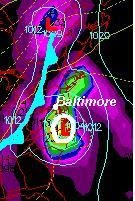
The overnight run had the center of Hanna just north of Ocean City at 8pm on Saturday. You will notice the yellow shading over Baltimore that indicated the heaviest rainfall just north and west of the center. Often times these storms will dump more our way than near the center as it interacts with higher terrain and other weather systems.


The Canadian Model also shows 8pm Saturday for the close approach of Hanna.
This position is a little farther south- or just over the southern Chesapeake Bay. If anything, I see the same path, just a slighter slower solution. The time frame here still has us with the worst between 6pm Saturday evening through midnight.


I was looking at the higher resolution NAM model and was concerned with an attempt to slow down or stall Hanna on top of us.
Here you can see the 8pm Saturday evening position near Raleigh/Durham, NC, then reaching us on 8am Sunday. That is a dramatic slow down, and seems to be the only model doing so.
While the cold front to our west is falling apart, the upper level winds will still have enough of a southwesterly push to keep Hanna moving at a brisk pace ranging from15-25mph. This may be using bad data, but I needed to mention it just in case it found something no one else is seeing.
Rainfall
Basically, using the Hydrometeorological Prediction Center maps, here is the forecast for rainfall:
There is a bulls eye (X) over northern New Jersey with 7.99 inches.
Baltimore: 5-6 inches
Westminster: 4-5 inches
Annapolis/Easton: 5-7 inches
Ocean City: less than 4 inches.

All impressive amounts, but should be taken with a grain of salt. There are so many things that can influence rain totals, mainly if and where rain bands set up. We could get a lot more in spots, or a lot less. Either way, the idea goes along with what I mentioned above. The heaviest rain will fall just north and west of the path of Hanna.


Just to recap my forecast:
This evening: Chance of thundershowers.
Tonight: Developing rain/thundershowers. Especially by morning.
Saturday morning: Rain and wind E 10-25mph
Saturday afternoon: Heavy rain, wind E to NE 25-45mph. Temperatures: Mid 70s
Saturday 6pm - Sunday 2am: Heavy rain, water level 1-3 feet higher on the west side of the bay. Wind ranging from 35-65mph Strongest winds on the Bay and Eastern Shore.
Sunday: Clearing, breezy early. Fine for the Raven's game in the afternoon. Partly cloudy to mostly sunny. High 80-85F

Thursday, September 4, 2008

Hanna Update: 6pm

Flash Flood Watch and Tropical Storm Watch

This is just a quick update since I am saving my energy for a late night of football. A flood watch has been issued for most of us west of the bay in addition to a Tropical Storm Watch on the water. The NHC plot just updated what I saw at 11am.. models are pulling back a little to the west. That places the center of Hanna between Annapolis and Ocean City mid day or early afternoon Saturday. That also means an east wind for most of the event. While Storm Surge will be limited, the water on the bay may pile more on the western side and raise water levels an extra 1-3 feet in addition to waves. The wind forecast is for 40-60mph, including near Baltimore. Much more tomorrow morning... My full post on similar tracks from this morning is below.

Hanna's Track Shifts Slightly-THIS IS NOT ISABEL

More on Hanna and recent similar storms is posted below. Also, a reminder that this blog is part of my full web site. If you do not see more images at the right here, then click the link above for the full web site.
First, I am thrilled that a lot more of you have taken interest in my blog, but I am amazed how may questions I have gotten about this storm and Isabel. I discussed this earlier in the week- just a few posts back... but I guess I should revisit it again.

THIS IS NOT THE SAME STORM AS ISABEL.

  • Isabel reached 150mph winds a few days before landfall-then weakened. The wave memory of that strength is what reached us. Hanna is still a Tropical Storm and only expected to be a minimal Hurricane.
  • Isabel tracked to our south and continued inland- pulling steady south east winds up the bay. Hanna should 'turn the corner', and pass off of the coast. It may clip Ocean City, and looks more like the paths of Floyd('99), and...Charley ('04).
I was an expert witness on a case regarding Isabel, and wrote up a 36 page report describing the unique nature of that storm. The 5 year drought, leading into record snow and very wet seasons. The result was water levels raining 2nd and 3rd all time in many spots- before the storm arrived. Then the track of Isabel itself was extremely rare. It passed north of Cape Hatteras, the point on the map that sticks out on the eastern seaboard. Most often, north of there a storm will encounter the mid latitude Westerlies and turn as a result. Isabel passed north of Cape Hatteras, which allowed that high wall of water- the Storm Surge, to pass unimpeded into the Chesapeake Bay. The track never wavered, and continued northwest up towards Toronto. Flooding was from the surge, not the rain. Check out the path and forecast plots here.

High Tide
Flooding in these storms often comes in two forms.
  1. Down- Rain from the sky.
  2. Up- Storm Surge upon landfall. This is the most destructive.
Despite my confidence and attempt to calm the fear of a repeat, people who live along the water will be watching the high tide and timing of the storm for surge flooding. Bowleys Quarters in Baltimore county seemed to get hit the hardest, I thought I would post their High Tides here. The mid day High Tide on Saturday would be the one of most concern. With the expected track and timing now... the following High Tide early Sunday morning should come with a northwest wind, blowing or draining water out the bay.
Tracking Hanna- Why it Shifted East.
Early this week, I was pumping the track from the National Hurricane Center directly over Baltimore. I tried to make it clear that the the range of time and error would likely bring it close, but not directly on that path. For two straight days, the models I look at were consistently plotting Baltimore. Then it began to show a shift to the south and east. Why?
Weather is all about 'teleconnections'. One storm can be impacted by one or a few others. Or even a ridge of High Pressure such as the one that steered Gustav, but gave us clear skies. As Hanna delayed it's development and turn north an extra day, it allowed the remains of Gustav and the Cold Front to our west to get a little closer to us. Carry this to Saturday, and the steering winds are expected to make Hanna turn north then north east before reaching us.
This GFS plot, compared to the last few days, does show a path over Ocean City on Saturday afternoon. That would sift out winds to more of a Northeast to north direction when the storm gets close. The water level in the bay may run high, but also could drop as this happens as the direction of the wind will help 'push' or 'drain' more water out. This could be counteracted by heavy rain, but definitely different than Isabel. Below are the overnight models and National Hurricane Plot for comparison to the last few days in my previous posts. Beyond that is a comparison to recent storms with the same path- Floyd and Charley.
Computer Models- Spaghetti Plot


Two Storms: Similar Paths, Different Outcomes

While working on a comparison to recent storms with similar tracks, I found two with very different results for Maryland. For starters, it is similar to Floyd, but that was a much stronger storm. At one point, Floyd was on the verge of reaching Category 5 status, and keep pushing from initial threats in central Florida to North Carolina. It was a Tropical Storm when it reach Maryland and passed nearly on top of Ocean City. It was responsible for over 6 inches of rain in Baltimore, 11-13 inches of rain in Annapolis and nearly 20 inches in parts of the Eastern Shore. Ironically, Ocean City had less than 2 inches of rain.Perhaps you remember the images of the town of North East in Cecil County, or Port Deposit at the point where the Susquehanna meets the Chesapeake.


More recently, Hurricane Charley. That came on shore in Florida's Gulf Coast as a Category4, weakened as it crossed into the Atlantic, then hit North Carolina and crossed over Ocean City in a diminished form. By that time, although a similar path to Floyd- no rain fell on the west side of the bay. Quite a contrast.

Wednesday, September 3, 2008

Hanna Hype, Track To The Right

I hate to skip past our local weather- especially with this late season heat surge, but at least it reminds many that it is still summer, and we have a lot of energy in the atmosphere just waiting to be released.
Here is the GFS model for Saturday morning. It has the center of Hanna just a little closer to the coast, but still very close. Do you remember my right side bias with tropical systems? I have been able to point it out with most storms whit season, except Gustav. Many of these tropical systems have ended up traveling on the right side of that forecast cone. Well, below are the latest tracks for Hanna. You can see a shift to the right side of the track- or to the east. Not much, but still worth noting. While I have pumped up the path crossing Baltimore for the past 2 days, I would have been surprised if that worked out just like that, but I still expect wind and rain Friday night into Saturday. We have to consider a few things:
1. Hanna is just starting to turn this morning. When it does, and the exact angle of acceleration will help determine landfall and beyond.
2. Wind Sheer is relaxing. Hanna has taken a major hit with upper level winds recently, but that relaxes today and allows it to regenerate over warm water.
3. North Atlantic Storm. This Low east of New England actually produced a band of rain in MA that dove south through Long Island. It is producing a band of clouds just to our east this morning. This does need to get out of the way, but could take it's time and deflect Hanna
4. Cold Front from the Great Lakes should help accelerate Hanna and push it out of here in a hurry. These fronts often get here later than expected, and will also determine how Hanna gets turned and spun through the Mid Atlantic. The longer Hanna takes to get here, the closer that front gets, and a better chance to keep Hanna farther east. However, the interaction with the cold front will produce another band of heavy rain and severe storms away from the storm center.

While the Atlantic is now filled with 3 Tropical Storms, let's focus on Hanna maps below. You'll Notice that the National Hurricane Center keeps Hanna as a Tropical Storm when passing us on Saturday.

Tuesday, September 2, 2008

Hurricane Hanna Heading Here! Tropics Bubbling Up!

Hanna has been upgraded to Hurricane status overnight.
This is the GFM model I mentioned yesterday, still on target with a direct hit from Hanna on Saturday. While the storm be in a diminished form, much like Gustav is today... it will still pose a threat for flooding rain, strong winds, and isolated tornadoes.
While there is a lot of anxiety in this region since Isabel, this will not be the same storm. For starters, it's not nearly as strong, nor projected to get much stronger.
Secondly, the track takes it into South Carolina and brings it up from a longer trip over land. The wind flow may provide some surge of water up the Chesapeake, but both South and North Carolina will take the main hit with water. Check out the tracks below.

First the Spaghetti Plot here shows more models than yesterday bringing this into Maryland. The bulk do have it to our west, but these hurricane models don't handle mid latitude winds that well. The GFS (seen above, and here in red line) does have it much closer to Baltimore.
The National Hurricane Center Forecast Cone considers all models, and perhaps the bias I have mentioned all summer. There is a trend of these storms to ride to the right side of the forecast track... although Gustav did buck the trend. The range of possibilities is wide on Saturday, but below you can see the NHC forecast taking Hanna here Saturday!
As Gustave winds down to Tropical Depression status this morning, it still may dump anywhere from 6 to 20 inches of rain in the deep south. Yet Look at all the activity in the Atlantic below. I think the popcorn might be ready in the microwave.... Ike's track takes it into the Bahamas in TEN may be named Josephine by the end of today.

Monday, September 1, 2008

Summer Finale. Gustav on the Gulf. Hanna Could Hit Us

Labor Day is often viewed as the end of summer. At least since it marks the end of the State Fair, and kids are back in school. Heck, even the leaves have started to turn- but I will have to save that discussion until this tropical week ends...
I heard a story on the radio early this morning on my way to work... The New York area beaches have had a dramatic drop in visitors this summer. The reporter mentioned the lack of 90 degree days as the reason...and I think we have had a similar set up down here. Does it seem like we have not had much of a summer? Here you can see that the number of 90F degree days have dropped off each month this summer. June- 9 days, July- 8 days, August- only 4 days.

Hurricane GUSTAV
Just a watching game now. You can track along on the Tropics tab above (main web site). My only question, as a broadcast journalist- all the coverage you will see on TV today will be from reporters and cameras in locations that were evacuated. How safe can they be?

Tropical Storm Hanna
Here is the overnight (spaghetti) 6 model plot. As you can see, there are a quite a few solutions, all of which take this on shore. The red line is the GFS, which brings it over Baltimore- after trekking through North Carolina and losing some strength. At the forward speed, this model does have it as a minimal Tropical Storm when reaching us. Below is the GFS Model for Friday night. You can see the center of the storm just to our south, and heading our way. This model is important since it is one of the primary models we use for our mid to long range weather, and can take over from the Tropical Models by adding in land data those don't incorperate. This is the second day I have seen this scenario, so it is worth watching for consistency. This is just one of many possibilities. As of now, we have at least 5 days to prepare...