Today's (March 12) record high temperature in Baltimore was set at 86F. But downtown was 95F. The hottest in the nation that day, and the only time Baltimore has held that honor. It should be noted that was at the old Custom House site, where the sensors were on a black tar roof! Currently the city's official data recorded next to the Maryland Science Center- by the cooler Inner Harbor water. Regardless- it does mark a hot week in the nation when 283 record highs were set between the 11th and 15th. This extreme heat points to my theory of balance according to the law of averages. It was 12 days later- March 24th- Baltimore had a record 1.4" of snow.
The next storm:
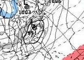
Here is the Canadian outlook for Saturday morning. 

Basically- I am looking for a 60F day on Friday- and night time temps may stay in the 50s. That Saturday temperature will play a role in the energy that can feed into the storm. Last week we surged well above expectations- so I will play this day with caution.
It's a matter of track that will determine who gets a heavy snow out of this- but most likely not us.
Wednesday, March 12, 2008
Hot Week- 1990
Labels:
Weather History
Subscribe to:
Post Comments (Atom)


No comments:
Post a Comment