

Temperatures and Hurricanes
First: Our temperatures...It's been an interesting ride this week with our marine layer. While just about every morning has had fog, each afternoon has punched a bigger hole in the cloud deck. As a result- our temperatures have jumped each day.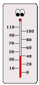 Mon: 47F
Tue: 51F
Wed: 61F
Considering that our normal high is 63F- this has been a big improvement. Now we get the flip side. We can thank the cold front (producing severe storms out west in the Mississippi Valley) for shifting our winds and bringing us back above normal by this afternoon. Think of it this way- our sun angle now - nearly 3 weeks after the Spring Equinox- is roughly equivalent to the sun angle 3 weeks before the Fall Equinox. That is early September when normal high temperatures are 82F. That does not happen often in April since the ground and water is still warming up from it's winter chill. However there is solar support- so low 70s are pretty likely once we get the sun back out.
Tension in the Tropics:
An increase in the 2008 hurricane forecast was released by Dr. William Gray yesterday.  Essentially the Hurricane guru gave a 69% chance that a major hurricane will strike the US this season (June 1- Nov. 30). That breaks down to 45% along the east coast and Florida Peninsula, and 44% through the Gulf Coast to Brownsville, TX. More details below..
It should be noted that most tropical experts agree that we are in a normal 30 year cycle of increased tropical activity. The extremes 2004 and 2005 are not expected to repeat, and as I wrote yesterday- there are other factors such as African dust storms that could inhibit storm formation.
Tropical Cyclone Forecast for 2008
(1950-2000 Averages in parenthesis)
- Named Storms 15 (9.6)*
- Named Storm Days 80 (49.1)
- Hurricanes 8 (5.9)
- Hurricane Days 40 (24.5)
- Intense Hurricanes 4 (2.3)
- Intense Hurricane Days 9 (5.0)
- Net Tropical Cyclone Activity 160 (100%)
* Numbers in ( ) represent average year totals based on 1950-2000 data.


No comments:
Post a Comment